Lakagígar – 82 km from Dalshöfði Guesthouse
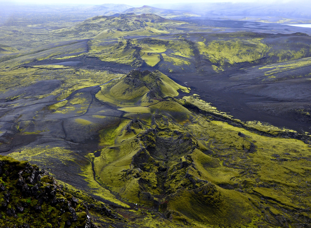
Lakagígar is a magnificent 25 km long row of craters in Síðumannaafréttur. It stretches from the tuff stone cliff Hnúta, to the northeast through the tuff stone cliff Laki, which rises 818 meters, and ends in Vatnajökull. Laki stands approximately in the middle of the row of craters and from it there is magnificent view of the row of craters and the surrounding landscape. It is safe to say that the view of the area is spectacular, due to both unique nature and the history of Lakagígar.
Lakagígar became part of Skaftafell National Park in 2004. Skaftafell National Park then became a part of Vatnajökul National Park in June 2008. Lakagígar is considered one of the most remarkable geological remnants of the world. On June 8, 1783, one of the biggest lava eruptions of historical times began, and caused severely hard times in Iceland. The torrent of lava poured down the river-bed of Skaftá, filled the gorge of Skaftárgljúfur, which was thought to be 200 meters deep, and then spread out over the lowlands at Síða and a few farms. A lava branch flowed to the east along the mountains of Síðufjöll and stopped at a point, which is now called Eldmessutangi, over a month later, on July 20, 1783. The lava eruptions didn’t stop there though. Just over a week later, on July 29, 1783, volcanic activity started again and then an eruptive fissure opened to the northeast of Laki. The torrent of lava flowed down the river-bed of Hverfisfljót, filled its gorge and spread out over Fljótshverfi. The eruptions stopped in February the next year, 1784. This is believed to be among the most amount of lava that has flowed on earth in historical times.
During the eruptions, large amounts of volcanic ash spread all over the country, though the layer of ash never became very thick. Following the eruptions, severely hard times followed in Iceland, known as Móðuharðindin. The nation suffered famine during the years of 1783-1786 which resulted in a population drop of 20%. It is also believed that 82% of sheep, 53% of cattle and 77% of horses died subsequently. Volcanic ashes and sour rain from the eruptions also spread further, reaching Europe and the whole northern hemisphere.
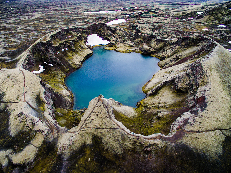
The Lakagígar row of craters stretches about 25 kilometers and the lava field of Skaftáreldahraun is thought to be around 565 km2 and 12 km3. It is believed to stretch around 60 km, but it’s safe to say that these numbers don’t give a complete or clear picture of the enormous mass of lava that flowed there. Magnificent history and beautiful landscape characterizes Síðuafrétt. Most of Lakagígar are today covered in woolly fringe moss, and it’s worth to note that lava slag is loose, crumbles easily and the moss is very fragile. Therefore, tracks disappear slowly from it, making it all the more important to follow the rules of conduct, only follow marked paths, use the facilities at Laki and Tjarnagígur, and not drive off-road. There are five marked walking paths in the area, which was first proclaimed inviolate in 1971 and is extremely sensitive to intrusion. Travellers are therefore encouraged to seek information before entering the area.